
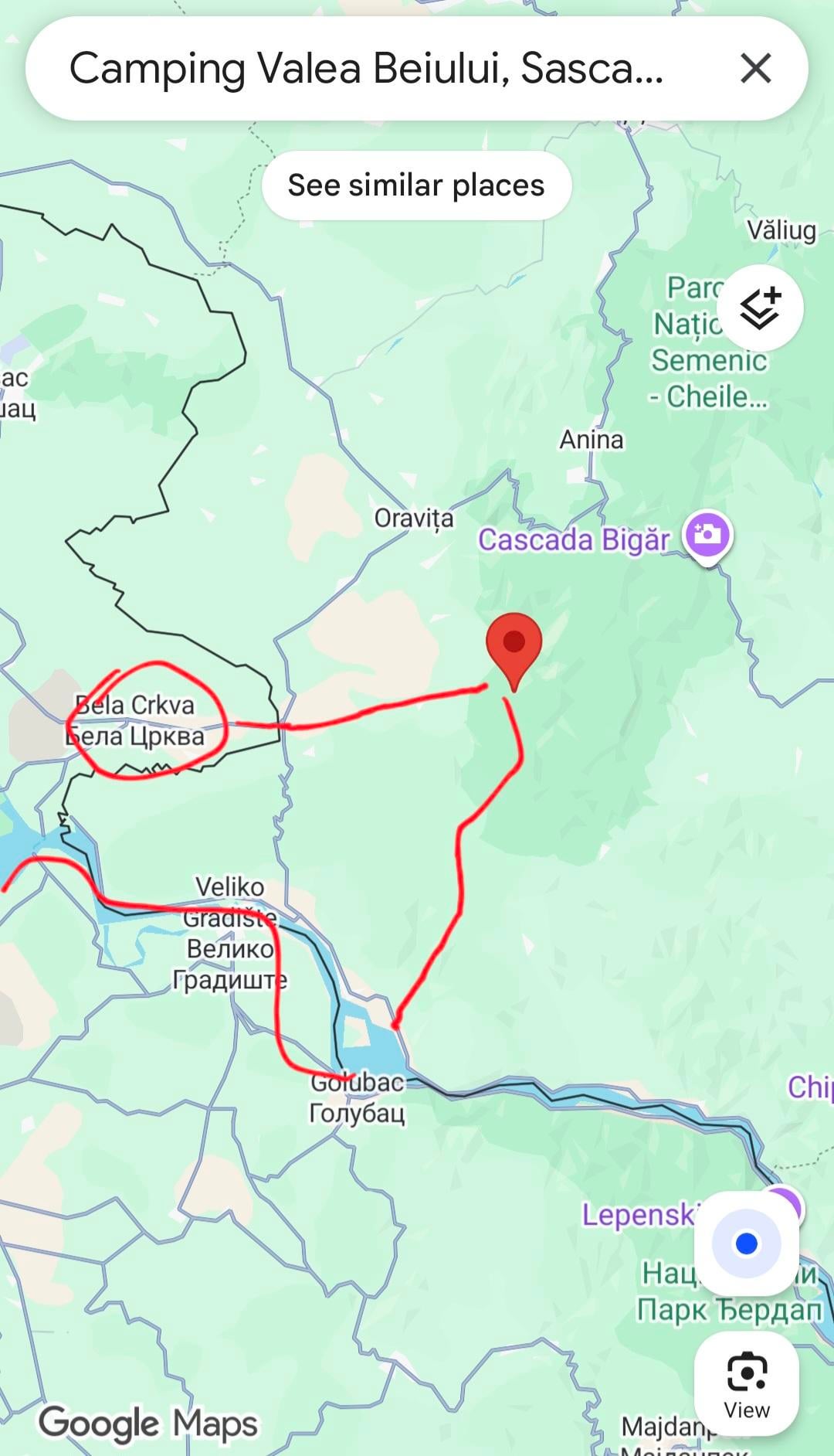
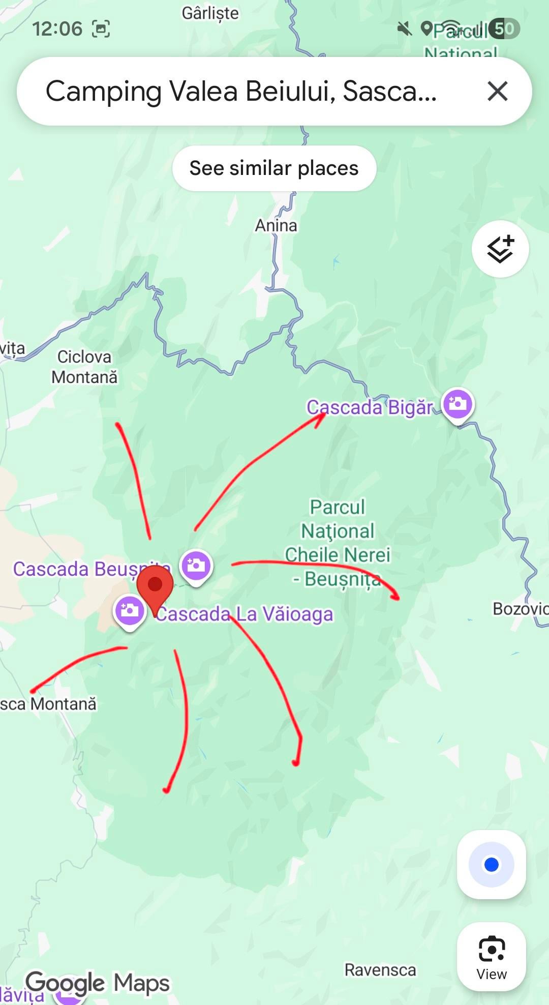
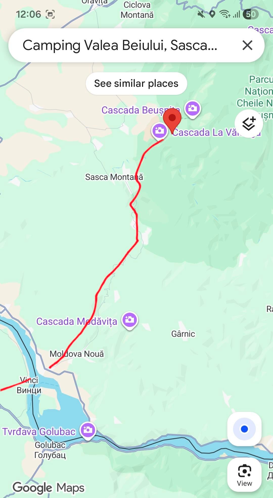
Hi everyone, this summer me and my friends are planning bikepacking trip from Belgrade across Chelei Nerei Beusnita National Park in Romania, across Danube back to Belgrade.
We will camp in designated area Camping Valea Beiului bc of bears and stuff…
We want to explore whole national park and its beauties. My question is connected to roades in that part of Romania. In Serbia its almost 100% flat to the border with Romania. Later i dont know what is whaiting for us.
I would appreciate if someone could guide me through roades, elevations, difficulty…we would like to ride on more quieter and less populated roads. Also later the route i marked back to Serbia, is it flat, busy…..
Every suggestion will help me. Also our plan was to park bikes in camping spot and later hike trough national park, but if there are some cool forest paths we would pike to explore them by bikes. thanks in advance for help 🙂
Here are pixtures of routes we planned:
by VolimRexa32
1 Comment
Use osmand or locusmaps (this also has a website map) to get an elevation plot on your route. I went by car in RO through there and I remember it being pretty hilly
Through the national road DN57, there’s a peak elevation of 400m. There’s also this more direct route with 500m max elevation, probably free of trafic but also very probably bad road (I haven’t been through here nor have any idea how it is or if it is): https://osmand.net/map?start=44.708282%2C21.644222&end=44.902374%2C21.748312&profile=bicycle#11/44.753450/21.670942
But be warned, the road from DN57 to Potoc is also bad.
LE: On that direct route from Moldovița to Cărbunari, Știnăpari, Sasca montană and then Slatina Nera should be a road; you can see street view on GMaps through here