
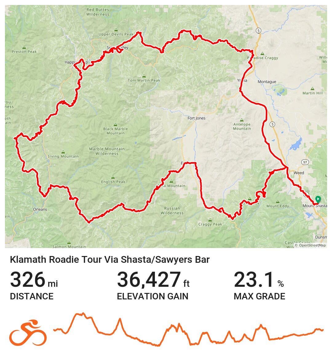
Im planning a bike tour later this spring that is going to be dipping into all three counties. Planning to camp all nights over the length of the trip. Im adding a screen shot of the route i made, as well as the link for the route that has more information.
Questions id like to know are
-are these areas safe?
-how are the roads? Quiet? Scenic? Any reroute suggestions?
-are there any points of interests or campgrounds youd like to add or suggest?
by Meowriano
2 Comments
I have long planned a loop trip thru this area, but have yet to do it. My proposed loop is 100% paved and sticks to the main highways: starting in Weaverville heading north on Hwy 3 to Yreka, then Hwy 263 to Hwy 96 and follow that down-river along the Klamath all the way to Hwy 299 at Willow Creek. Hwy 299 is unsuitable for bicycling, but there is a local bus that runs from Willow Creek back to Weaverville.
I also looked at a shorter loop based in Yreka or Etna, cutting thru the mountains via Forks of Salmon, as you have in your route. I don’t know if those roads are safe or otherwise, but my expectation is they are not going to be very busy. Either way, my thinking was to ride the loop counter-clockwise – Hwy 96 down-river – for, ya know, net elevation loss for a big portion of it!
Your route includes a number of remote forest roads that are likely to be dirt, damaged, unmaintained tracks thru burned areas – they will probably be extremely rugged, but you may see Bigfoot! Good luck with this one!
Super awesome.