
Pretty much the title. I know most of it will be fine but there is a lot of hiking trails. I'll be on a high end mountain bike and have cycled other hiking trails before, but it's very difficult to know what the terrain is actually like on the ground. I would have to cycle a fair bit through Sarek national park. Is this possible? Is there another way (without cycling on the e10 for days) ?
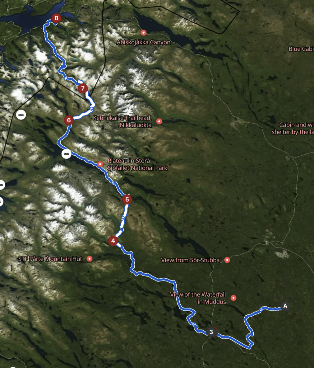
The white sections are hiking paths. The numbers are overnight stays.
by Fyjgfyjjgddr
1 Comment
Great to see others planning to cycle there off the beaten roads! I’m planning to start from Tromso/Nodrkjosbotn around 2-3.08 and ride south through the mountains and valleys.
Here you can see no-go zones for the bikes in Norway (the yellow ones): [https://mtbmap.no/#7/68.562/15.579](https://mtbmap.no/#7/68.562/15.579)
+ local signs may also prohibit the riding.
Personally, I wouldn’t try cycling through Sarek. On the Kungsleden, which goes along the border and doesn’t go deep into the park, I guess it may be tolerated (or at least walking the bike for a few kms within park, to keep things legal). But through the middle of the park? Definitely no. And Padjelanta is definitely a huge no. What concerns me is this ridiculous report (https://bikinggreenribbon.wordpress.com/):
>In summary, I made it all the way to Staloluokto in Padjelanta National Park where my journey was terminated. Apparently, cycling is not allowed there and I was sternly informed that the only way out would be by helicopter (!!!) as walking with my bike to the park’s boundary was also a no go. A bit of a bummer after riding 2000km, but alas, an expensive lesson learnt.
If you don’t mind using some auto-translate from polish, there’s a great blog of one of the thru-hikers who posted some photos from the trails in discussed area with detailed descriptions of the stages she walked:
[https://acrossthewilderness.blogspot.com/p/skandynawia_2.html](https://acrossthewilderness.blogspot.com/p/skandynawia_2.html)
It may require a bit of work, but you should be able to localize the places where photos were taken basing on the description.
I’d rather think about your offroad riding experience and tolerance for riding some slopes full of TV-sized stones (slippery as ice when wet!) rather than the cost of your bike. Generally that area seems to be a complete mix of various trails. Generally, most should be closer to blue flow trails rather than chunky reds with not too many stones in the paths. But some sections will surely be endless boulder fields that force you to push or even carry the bike. Oh and the bogs! Long sections of narrow northshores shared with the hikers.
Of course, everything varies from place to place and neighboring trails or even sections of the same trail may be completely different, but here’s an example of the terrain from the valley west from Abisko:
[https://www.youtube.com/watch?v=W2XMa_716rQ](https://www.youtube.com/watch?v=W2XMa_716rQ)