
# Hey Reddit, I’ve used this platform and its community knowledge to inform my bike-touring trips in the past, so I thought it would be nice to give back.
# Here are some detailed trip notes about our bike tour down the Rhône river. (Eurovélo 17, during August 2023).
Summary:
* Two women in our mid-30’s, sporty, but not biking every week/weekend.
* 670km in 11 days (60km a day average)
* Sleeping mostly in campsites, with some exceptions.
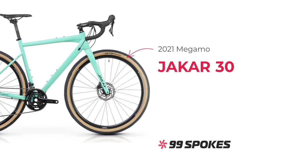
* Both riding a [gravel](https://99spokes.com/bikes/megamo/2021/jakar-30) (Megamo Jakar 30, 2021)
* Setup: Traveling with two panniers on our back wheels + a small bag on our handlebars + two water bottles each (12kg in total per person approx). Our load comes from a tent, blanket, light compact air mattresses, a small table, some plastic kitchen cutlery and plates, clothes, and bathing + swimming gear.
[Bikes at the ferry, right at the end of our trip.](https://preview.redd.it/af065sd069sb1.png?width=2018&format=png&auto=webp&s=76bf618933f2e9670cd027e0273ebf9f5871bdc5)
^(\*This is a translated version of the original notes I took along the route in my native language, excuse my English.Please feel free to comment if something is not clear or if you’d like some tips.)
# _______________
# Via Rhôna
The Via Rhôna is a part of Eurovelo 17 that follows the Rhône River from Lake Geneva, passing through some cities like Geneva, Lyon, Valence, Avignon, and Arles, and ending in the Mediterranean Sea at Port-Saint-Louis, in the beautiful Camargue region. It’s our second bike trip, adding to the 550 km journey we completed in 2022 from Narbonne to Bordeaux through the Canal du Midi and Canal de la Garonne. You can see both routes [here](https://api.mapbox.com/styles/v1/berts189/cllc6nk4s00fy01qphz6gg9jt.html?title=view&access_token=pk.eyJ1IjoiYmVydHMxODkiLCJhIjoiY2xsYXl6dndzMDMwdzNlbWc2NDl4ZHltYSJ9.uEX8UbAoLL0zjsLbYJ9hIw&zoomwheel=true&fresh=true#4.06/48.95/8.95).
The section we traveled is a route of 670 km from Seyssel in France to Port Saint-Louis in the Camargue. (Skipping the Alps and its altitude, if you’re here for some Tourmalet-like stage trip, this is not your post 🙂
[Route break-down.](https://preview.redd.it/otyelf3hl7sb1.png?width=616&format=png&auto=webp&s=1a9e851f473afb83b28940de2bbef2e6073cb2f7)
[**https://www.viarhona.com/itineraire**](https://www.viarhona.com/itineraire)
This website greatly facilitated the organization of the trip. It allows you to customize your stages, and see the elevation, terrain type, and distance. You can also find some bike-friendly campings and hotels on it, although there are many more available.
# _______________
# Traveling by train with a bike (*Disclaimer, this section could be very specific to our route)
The AVE train requires bicycles to be packed in a bag no longer than 120 cm, 40 cm wide, and 90 cm high. This means that both wheels must be removed. [Decathlon](https://www.decathlon.es/es/p/funda-transporte-bicicleta/_/R-p-326610?mc=960035&LGWCODE=2&gclid=CjwKCAjwxOymBhAFEiwAnodBLA8fab4385Iw3ZBEswF7oivQbQF0G0zV9u1EDbqqQj13Umrp9reAVRoCD7IQAvD_BwE&gclsrc=aw.ds) offers bike bags that weigh 1,4 kg and cost 70€, but we ruled them out due to their weight, even though they were more durable. We ended up using [BUDS](https://buds-sports.com/es/collections/roadbag/products/housse-velo-de-route-roadbag-light?gclid=CjwKCAjwxOymBhAFEiwAnodBLPx9XSsd5_-jCpT3s9Dr2OFGKctWmz5F-op6yyDoXaouCneMJ46OrhoCS_AQAvD_BwE) bags that cost 70€. Each bag weighed 0,7kg and took up much less space.
To protect the bicycle, as the travel bags are quite thin and provide little protection, we wrapped them with bubble wrap (the frame, derailleur, cassette, and chainrings) and placed cardboard on both sides of the wheel to protect the spokes. We also placed cardboard on the lower part that touches the ground (chainrings and derailleur) and on the fork for added protection. Upon arrival, we discarded all of this and started our journey. It’s important to set aside about 2-3 hours to disassemble the bicycles and prepare them for travel, as well as about an hour to reassemble them upon arrival. This process can be tricky if you’re not familiar with removing pedals and/or wheels, especially the rear one. It’s advisable to practice this in advance and also carry a spare inner tube in case of a puncture since these processes require practice, and in many parts of the route, there won’t be any bike shops to stop at for repairs.
The AVE train requested that the pedals be removed, but we didn’t do that; we only wrapped them in bubble wrap since, with the pedals still attached inside the cover, the width requirement (40 cm) wasn’t exceeded. Properly protecting the bike and adhering to the specified measurements is crucial because these are the dimensions of the scanning machine at the train station. If the bike doesn’t fit through the machine, you won’t be allowed to pass the control. Furthermore, once on the AVE, there isn’t a dedicated space for bicycles, so they must be placed where luggage goes, and these spaces have a width of 120 cm. We placed the bikes horizontally on top of each other.
[Bikes at the train station scanning machine + Packing the bike process ](https://preview.redd.it/qm888sztx8sb1.png?width=840&format=png&auto=webp&s=f0f8b979e0157e37402e4d750dbb74d68a3649a9)
​
# Stages
# Day 0 (Transport from Girona to Seyssel)
* 09:00 AM AVE from Girona to Lyon (29€ per person)
* 1:20 PM Arrival at Lyon Part Dieu (4 hours and 20 minutes)
* 2:38 PM TER from Lyon to Seyssel (14.10€ per person)
* 3:50 PM Arrival in Seyssel (1 hour and 12 minutes)
Upon arriving in Seyssel, we assembled the bikes right at the station. It took us about an hour for everything. We disposed of the cardboard and bubble wrap, folded the covers, and placed them in the panniers. We headed to the Seyssel campsite, where we would spend the night.
The campsite is called Haute du Rhône. We reserved a wooden cabin because rain was expected, and it turned out to be a wise decision as a heavy downpour started shortly after we were settled in. The cabin cost us 55€, and we made the reservation a couple of days in advance by phone (they don’t have online reservations). There is also an “emplacement vélo” (bike area) that we would come across often during the journey. It’s a section of the campsite where all the tents of cyclists are set up without defined plots. They typically cost around 10-12€ per person. The bike area in this campsite is very nice, with picnic tables, grassy areas, and beautiful shaded spots. The campsite, small and very green, is right next to an Intermarché; it has a bar, a swimming pool, ping pong, and a chill-out area with views of the Rhône River and the village. It provides direct access to the Via Rhôna and the riverbank, where you can dip your feet in the water.
[\(Seyssel at dusk, after the rain\)](https://preview.redd.it/uvrwe2c449sb1.png?width=666&format=png&auto=webp&s=c97c76bbe5f7d3b3f53974749e6c16cd0a3c6a13)
(Seyssel + Camping Cabins)
# _______________
# Day 1 (Seyssel | Murs-et-Gélignaux)
* Distance: 58.18 km
* Elevation: 183m
* Moving Time: 3 hours and 35 minutes
* Total Time: 4 hours and 48 minutes
https://preview.redd.it/0a4y4aoxn8sb1.png?width=958&format=png&auto=webp&s=68631181e84dd15188c5f45b1c76b57c546303fa
In the mornings, it’s quite chilly. We set off at 10 a.m., and it’s still a bit cool. It’s challenging to start earlier, but it’s recommended because temperatures can get quite high around noon (check the temperature map; we experienced this during the last stretch). Nevertheless, our tent doesn’t dry completely (there’s humidity at some stages), so it’s hard to find the ideal departure time.
The route begins spectacularly, passing through Seyssel, a beautiful village, and continues for about 3-4 km along a paved \**piste cyclable* that follows the Rhône. This will be the pattern of the journey, although we don’t know it yet. Around km 5 of the route, there’s a temporary section that leaves the riverbank. After crossing the bridge on the right, there’s an ascent on a road, shared with cars, of about one kilometer (about 40 meters of elevation gain, check the elevation map).
We will encounter some similar climbs during the stage. This temporary section lasts for about 4 km, during which we share the road with cars. The shoulder is wide, though, and it is well-marked as a bike lane. Additionally, the road is moderately busy.
When the temporary detour ends, we begin about 14 km of a cycle path through forests, villages, and shaded areas until we reach Chanaz, a lovely little village by the river. It’s recommended to stop here for a coffee. From Chanaz to Port Massignieu-de-Rives, there are about 8 km of riverside *piste cyclable* with not many trees (sunny!). After passing Port Massignieu-de-Rives, there’s a short ascent of about 500 meters until we reach the bridge that crosses the Rhône. From here to Murs-et-Gélignieux (30 km), it’s a cycle path along the riverbank, asphalted and with very few shaded areas. There are few ascents, except for the 2 or 3 to go up to bridges that cross from one side to the other of the Rhône.
[\*Pistes cyclables are exclusively paved routes for bicycles, away from roads \(road shoulders do not count\). We will come across many of them along the route. \\”Voies vertes\\” are non-exclusive paths for bicycles, people walking, walking dogs, etc \(They are not necessarily paved, most of them are gravel\)](https://preview.redd.it/7ij5ho2co8sb1.png?width=938&format=png&auto=webp&s=7f8ee18fdb468f82c3eb3d62f69b9117a9da0e4e)
# _______________
# Day 2 (Murs-et-Gélignieux | La Tour-du-Pin)
* Distance: 50.79 km
* Elevation: 167m Moving
* Time: 3 hours and 4 minutes
* Total Time: 4 hours and 6 minutes
https://preview.redd.it/rdq9v7azq8sb1.png?width=882&format=png&auto=webp&s=a4bc8a3a65507c7716edc24476e2af009b795942
This stage is also very beautiful, mostly on cycle paths. The first 10-15 km are along the river with no shade. Until Groslée, it’s a mix of fields and riverbanks with few shaded areas. In Groslée, there’s a nice terrace to stop for a coffee (L’Hoslaterie du port de la Groslée). There, you cross the bridge and enter a more foresty and shaded area. From there to Morestel, it’s a mix of small paths and cycle paths.
In Morestel, we had a pain au chocolat at Boulangerie Marie Blachère, and right next door, we bought some fresh fruit at a local store. The place isn’t charming, but it’s a good stop because this stage doesn’t have many places along the way that offer a compelling reason to stop.
From Morestel, we return to passing cornfields and some in-between forest areas until we reach Vallée Bleue, a small community bordering a lake with a public swimming pool, a restaurant area, and a public campsite. It’s nothing extraordinary, but with entry to the campsite, you have access to the public pool. The restaurants are not exceptional either.
# _______________
# Day 3 (La Tour-du-Pin | Jonage)
* Distance: 61.83 km
* Elevation: 303m
* Moving Time: 3 hours and 54 minutes
* Total Time: 6 hours and 53 minutes
https://preview.redd.it/dukojdd0s8sb1.png?width=826&format=png&auto=webp&s=019fa925167bc31b475a451aed58ce58101ad9ea
The beginning of the stage is beautiful, along the river and through cornfields. Some chateaus are visible, and the area is still very green. Towards the end of the stage, there are more interurban areas, industrial zones, etc. The first section, from Montalieu to Sault Brenaz, is fantastic. It follows the river, all on a well-paved cycle path, far from cars. In Sault Brenaz, a village with a tradition of river canoeing, and almost all the way to Lagnieu, it’s also very picturesque, with mountains on both sides that have made way for the Rhône River, creating a green and beautiful valley where some chateaus have chosen to be located.
From Lagnieu, the scene starts to change towards more urban areas and the outskirts of Lyon. The section begins by crossing a quite busy roundabout and crossing the Rhône on a heavily trafficked bridge. We start to ride on more sections that follow road shoulders, interurban areas, and industrial zones.
In Val d’Amby, a charming little village, you’ll encounter a somewhat steep climb to reach the Place de la Mairie. After passing the village, you’ll start to see the first nuclear power plant of the trip (we’ll see up to 3).
We cross the last few kilometers through fields and cultivated meadows before entering a chain of villages, industrial zones, and roads until we reach Jonage. The entire route is paved except for the final section along the river in Jonage. This stage is not particularly tough, but it does have some unexpected climbs that work the quadriceps. It marked Sandra’s first descent from her bike!
​
# _______________
# Day 4 (Jonage | Lyon)
* Distance: 40.02 km
* Elevation: 150m
* Moving Time: 3 hours and 7 minutes
* Total Time: 6 hours and 53 minutes
https://preview.redd.it/48r68p02t8sb1.png?width=818&format=png&auto=webp&s=50e532fc0d3de9fb56f4616e94ddeb1d37ed2dab
We begin the stage on a gravel path from Jonage all the way to the Grand Large (perhaps about 10 km). Then, we cross a beautiful wooded area that takes us away from the Grand Large until we reach the Plage de Morlet. There, we start to skirt the highway and cross some industrial zones until we arrive in Lyon, where we again encounter a good stretch of fine gravel until we’re well inside the city.
At the city’s entrance, we stop at Parc de la Tête d’Or, a very beautiful space with various areas. There’s a zoo, a velodrome, a “Jardin des Plantes”, and much more. We have a bite to eat before continuing with the route.
Lyon is a city with quite a bit of elevation, and with our panniers, the wind, and the heat, we avoid the higher areas. We take a route through the flatter parts and see Place de la République, the Palais de la Bourse, the Fresco of the Lyonnais, the Cathedral, and Place Bellecour, among others. We skip the higher areas like the Amphitheatre or La Fourvière. Lyon is a city well adapted for bicycles, and you’ll easily navigate through specially designated and well-signposted lanes.
We spend the night in Oullins, a bit south of Lyon, at my cousin’s place. The stage itself is not spectacular, but Lyon is a very beautiful city, highly recommended for a visit.
​
https://preview.redd.it/elw53ndut8sb1.png?width=486&format=png&auto=webp&s=a991fa2a4929f59638ae059f9856c8760d05884f
# _______________
# Day 5 (Lyon | Andance )
* Distance: 61.35 km
* Elevation: 117m
* Moving Time: 3 hours and 52 minutes
* Total Time: 6 hours and 17 minutes
https://preview.redd.it/gsuimff5u8sb1.png?width=824&format=png&auto=webp&s=96824120f47a36900c8ad96a2bc9b56b8e0db7b7
A transition stage. The Lyon-Givors stretch is not suitable for bicycles, and it’s impossible to ride there unless you’re willing to risk your lives on highly congested, unattractive roads with trucks passing very close.
As suggested by the Via Rhona organization, we took a train to Givors (30 minutes, about 5 euros per person).
From Givors, the stage is somewhat transitional. It’s quite different from the ones in the north of Lyon. Many sections run alongside the river without much charm, roads, and villages with little shade, except for Ile de Beurre, where you can stop to observe birds and all sorts of flora and fauna, even beavers! The entire route of this stage is paved as well. We still have a headwind, which is very annoying and, as we’ve read, unusual because the wind typically follows the direction of the river’s flow and often blows at your back. We haven’t been lucky with the wind in these early stages, but we’ll appreciate it in the coming days when it finally becomes our ally.
Towards the end of the stage, we pass through many vineyards, so there’s little shade and a lot of scorching sun. As always, getting up early has its rewards. Waking up early remains crucial.
​
https://preview.redd.it/57yzn4j8u8sb1.png?width=444&format=png&auto=webp&s=1193fdaab94fb77fb2728ad5646553999798955a
# _______________
# Day 6 (Andance | Charmes-Sur-Rhône)
* Distance: 72.00 km
* Elevation: 182m
* Moving Time: 4 hours and 19 minutes
* Total Time: 7 hours and 21 minutes
https://preview.redd.it/nye1qzhmu8sb1.png?width=782&format=png&auto=webp&s=4af6ba72bbf0ec188f5651d06db8fb426d055fbd
This stage doesn’t stand out for its beauty compared to the alpine parts at the beginning of the route. Nevertheless, there are some beautiful sections. For the first time in days, we have a favorable wind pushing us, and we make rapid progress. A light rain doesn’t stop us. The town of Tounon-sur-Rhône is lovely, and we stopped for coffee around the 26 km mark, our first break.
We continue the route along the riverbank, in some places with slightly gravelly asphalt for about 10-15 km. Since it’s not sunny, we don’t notice it, but I would say it’s another stage with little shade. We even feel a bit cold at times! There’s a poorly marked temporary section between Tournon and Glun, so be cautious.
At 53 km, we stopped in Valence for lunch. It’s a big city, but the route is well-marked. From Valence to Charmes-sur-Rhône, the sun comes out, and we find it harder to make progress. We sleep at the Charmes-sur-Rhône Public Campsite. It’s not amazing, but it serves its purpose. 5€ per person, + 5€ for the tent, + 10€ for electricity. We sleep for 25€. The Carrefour supermarket in the village is only 3 minutes away by bike, and the campsite is right next to the ViaRhôna. The staff at reception are friendly, and the dinner from the food truck (La Guinguette) is highly recommended. It may seem like they just serve simple dishes, but they have a super good and well-prepared menu for what it is.
# _______________
# Day 7 (Charmes-Sur-Rhône | Viviers)
* Distance: 62.17 km
* Elevation: 194m
* Moving Time: 3 hours and 31 minutes
* Total Time: 5 hours and 50 minutes
https://preview.redd.it/k9qy5l9hv8sb1.png?width=754&format=png&auto=webp&s=23c682368bcca95881ab52e5cd002afddb5f14ab
Another stage partly along the river, partly through forests. Rochemadour is a very beautiful village with a castle perched on top of a mountain. It has a suspension bridge that is a major tourist attraction, and the Via Rhôna passes through it. You’ll cross it with your bikes!
Viviers is also lovely. The creperie Les Chavaliers is excellent for eating galettes (that’s what they call savory crepes in France). The galette with chicken curry and the one with river trout are exquisite.
Throughout the stage, we have a tailwind, and the sun appears and disappears thanks to some dense and kind clouds. This makes the stage enjoyable, even though there aren’t many shaded areas. You’ll pass in front of the Cruas nuclear power plant, which is quite spectacular. The route passes very close to the four cooling towers.
We stop at the Rochecondrie campsite, a bit off the route but allowing us to discover Viviers and be in a quieter environment. The campsite has large, shaded pitches, a peaceful swimming pool, and goats and alpacas grazing near the tents. They make pizzas right there, which are quite good for campsite fare.
​
# _______________
# Day 8 (Viviers | Avignon)
* Distance: 100.36 km
* Elevation: 220m
* Moving Time: 5 hours and 53 minutes
* Total Time: 8 hours and 7 minutes
​
https://preview.redd.it/9j1cfce1w8sb1.png?width=888&format=png&auto=webp&s=143dfcc69949c4bf3590d46d89c5aa0d2a5f8a91
With the favorable wind once again, we cover 100 km in this stage. We averaged 17 km/h, which is high considering the length of the stage and compared to the previous days. The wind does a big part of the work.
The stage consists mainly of stretches along the river and some interurban areas as we approach Avignon. Just outside Viviers, there’s a beautiful section through the woods. Overall, it’s another stage. We stopped for lunch around kilometer 60, mainly because in the 20-30 km before that, we didn’t find much to stop at without deviating from the route.
There’s a very good pastry shop at the entrance of the village where we stop for lunch, in Mondragon. It’s called Boulangerie Patisserie Testud. We grab some quiches, pastries, and a baguette, and have a picnic with some cold cuts and cheeses left over from previous days.
The next 40 km is a nearly 40 km long cycle path along the river, almost to the outskirts of Avignon, where the ViaRhôna starts to wind its way through interurban areas and industrial zones. The Avignon campsite isn’t very pleasant. It’s quite large and lacks charm, but it’s right in front of the bridge. We reward ourselves for the 100 km by having dinner in a lovely and delicious place in the old town of Avignon (Racines).
​
# _______________
# Day 9 (Avignon | Arles)
* Distance: 61.16 km
* Elevation: 163m
* Moving Time: 3 hours and 57 minutes
* Total Time: 5 hours and 37 minutes
https://preview.redd.it/y8sewsdcw8sb1.png?width=660&format=png&auto=webp&s=ed5e5e76db9c9813362c2d84afdcb97a5a97619e
For me, it was the worst stage of the trip. Several factors contributed to this. Firstly, it’s the day after completing a 100 km stage. It may not seem like it, but we’re slow, our legs aren’t cooperating, and we have no desire to pedal. Secondly, in the first 15-20 km after leaving Avignon, there’s a very unpleasant temporary section with gravel paths next to the roads.
The stage doesn’t offer a hint of shade, and if the sun catches you, it’s brutal. The mistral wind blows from all directions, and as soon as we’re not heading directly south, it hits us with gusts that significantly slow our pace and increase frustration. The stage itself isn’t particularly beautiful either. Many small roads between villages and an endless sea of cornfields.
There’s a good stretch of cycle path before reaching Beaucaire, which is a relief. In Beaucaire, we stop at Le Pastel bakery, run by two charming gentlemen. We have a couple of croissants and continue toward Arles.
The heat is intense, and the last 25 km are tough. We arrive in Arles, cross it from top to bottom, and stay at Camping L’Arlesienne, a city campsite. It lacks charm, is expensive, and not very pleasant.
​
https://preview.redd.it/gnlsawgew8sb1.png?width=830&format=png&auto=webp&s=0e212798d92f77b4263ff0efa4ba82014290ece9
# _______________
# Day 10 (Arles | Salin-du-Giraud)
* Distance: 61.16 km
* Elevation: 163m
* Moving Time: 3 hours and 57 minutes
* Total Time: 5 hours and 37 minutes
https://preview.redd.it/ivn969ejw8sb1.png?width=802&format=png&auto=webp&s=6b8f9e0c1fc81764e0f88ec8280aeecc6dfb0d3d
A great stage on the way to the estuary of the Rhône River. The entire stage consists of a well-maintained and paved cycle path, passing through the Camargue fields, windmills, bulls, horses, and all kinds of birds. 40 km later, we arrive at Salin-du-Giraud. We take a ferry that crosses the river (free for bicycles) to Salin-du-Giraud, where one of the best campsites of the trip awaits us (Camping du Bois Flotés de Giraud). It’s reasonably priced, with lovely staff and good facilities.
It’s the end of the Via Rhôna so expect the campsite to be full. Arrive early! (reserve online or arrive before 12). Following the campsite road toward the coast, you can reach the beach of Sainte Marie. Along the way, there’s a bird observatory, and we see flamingos and other birds.
We choose to reach the sea on this side of the river rather than Port-Saint-Louis because a local biker on the ferry convinces us that this side is much more beautiful, and the only attraction on the other side is that it’s the official ViaRhona route, but Port-Saint-Louis is quite ugly, and we won’t see many birds.
In the stages starting from Avignon, it’s crucial to check if there’s wind and in which direction it’s blowing. (The Mistral is typical in the region, and if you hit days when it’s blowing, it doesn’t stop for a few days.) We had gusts of 34-40 km/h headwind coming back from the beach, and it was very unpleasant.
​
# _______________
# Day 11 (Salin-sur-Giraud | Arles)
* Distance: 40.12 km
* Elevation: 31m
* Moving Time: 2 hours and 41 minutes
* Total Time: 5 hours and 34 minutes
https://preview.redd.it/0qo27rz7x8sb1.png?width=774&format=png&auto=webp&s=394acf048ef2c1163b3d7029505dc04ce345a8ff
The last stage is on the way back to Arles, following the same path as the previous day. We head back to catch the train, as it can only be taken from there. We woke up early and left the campsite with the tent still damp, knowing that we’d have to dry it upon arriving in Arles because there was a lot of humidity.
The route is not challenging, it’s all paved, but we push on in the early morning as the wind starts picking up throughout the day, and today it’s against us. We arrive in Arles in time to avoid the strong winds.
There, we will spend a few days because the town is beautiful, and we want to rest a bit before returning home. On our last day on the bike, we celebrated upon arriving as if we had won the Tour de France. 670km on our backs
https://preview.redd.it/02hxrqpdx8sb1.png?width=458&format=png&auto=webp&s=8880fd9f2be7b45423179212d6f011bb91977c1c
# Budget breakdown
|Expense Category|Cost (€)|
|:-|:-|
|Drinks|6.70 €|
|Cash Expenses|170.00 €|
|Accommodation|348.27 €|
|Restaurants & Bars|414.11 €|
|Snacks|97.87 €|
|Groceries / Supermarket|136.13 €|
|Transport (Train from and to Spain)|157.70 €|
|Total Sum|1,330.78 €|
|Total per Person|665€|
​
# Material, list of some things we consider key
^(Disclaimer: This is not a sponsored post. We have absolutely no links nor relationship with any of the following brands, but I think some products were a perfect fit for our needs so here we go. Also, you don’t need all of the following to go on a bike trip, everyone has their personal needs, and by traveling you’ll start to know what are your priorities. Ours is clear: Reducing weight.)
[**Intercom Sena**](https://example.com/sena)
* **Price:** 87,20 €
* This has been a key element of our trips. While cycling for hours, we can talk as if we were right next to each other, without having to shout or turn around, etc. It’s great for communicating, even if we have different paces. The battery lasts about 5-6 hours, and they connect to each other via Bluetooth. You can separate up to about 400 meters. It’s also handy for going into stores to buy things; one person can stay outside with the bikes and talk about what to buy inside, for example. Highly recommended. It’s not an earpiece that goes inside the ear and blocks external noises; it’s a small speaker that attaches to the helmet strap and stays just in front of the ear, emitting sounds.
​
[**Tent MT900 Ultralight Decathlon**](https://www.decathlon.es/es/p/tienda-tunel-trekking-2-plazas-mt900-ultralight/_/R-p-323505)
* **Price:** 240 €
* Weighing 1.75kg, it’s one of the lightest tents we found. Reducing weight is crucial when traveling by bike, and this tent has many advantages: It can be opened from both sides, which means you don’t have to climb over each other; it provides excellent moisture insulation; it’s very lightweight, easy and quick to set up; it has a compartment on one side where you can hide your backpacks, so they’re not inside the tent or left out in the open. Also, the groundsheet we bought to put underneath it is highly recommended as it provides excellent insulation from ground moisture and is very compact.
[**Blanket**](https://www.amazon.es/dp/B09M8LSY58/ref=twister_B0852Z39G6?_encoding=UTF8&psc=1) **and light inflatable mattresses**
* While traveling in the summer as a couple, we have found that the best way to sleep is to combine elements: 1 double blanket, 1 double mattress, and a sheet. The blanket is for colder nights, but on hot nights, you use the sheet. I recommend looking at the size of your tent and trying to make combinations, but our goal is mainly to reduce clutter and weight.
[**Panniers: Ortlieb Back Roller**](https://www.biciescapa.com/es/accesorios/transporte/alforjas/alforjas-traseras-ortlieb-bag-roller-classic-rear-ql21-55646?gclid=CjwKCAjwyNSoBhA9EiwA5aYlb7kdUe4e9LkfXrjIhoBg7u-JEf3X0XTQpMOPN-v1s7uq9D26tXj8bRoC-pcQAvD_BwE)
* Ortlieb panniers have also been a great help during the two trips we have taken. They were lent to us (thanks, Nuria!), and they did a great job. One mandatory feature is that they are waterproof. The specific system these have for attaching and detaching them from the bike is also key for assembling and disassembling every day.
**Bike Locks**
* Sleeping in campsites most of the time, we didn’t have any problems, especially in small French villages. We never left the bikes alone or far away, but having a lock to tie them together, for example, when you stop for lunch on a terrace, is always a good idea. We had: Two [spiral](https://www.deporvillage.com/candado-con-cable-kryptonite-kryptoflex-815-8-mm-x-150-cm) cables that we attached between the front and rear wheels of both bikes and a [folding lock](https://www.deporvillage.com/candado-abus-bordo-big-ugrip-5700k-100-sh) that we used to secure both bike frames together.
[**Chairs**](https://www.decathlon.es/es/p/silla-plegable-baja-de-camping-quechua-mh500/_/R-p-173601?mc=8492643)**,** [**table**](https://www.deporvillage.com/mesa-plegable-robens-adventure-aluminium-s?gclid=CjwKCAjwyNSoBhA9EiwA5aYlb2vrqL3eRLhMzNAAZTb2N-qDbiGLtXh94InRaMWnOo36Ai2bsoyh1xoCnPIQAvD_BwE)
* The first year, we went with a pack of chairs and a table (1kg per chair, 1.2kg for the table) so that we could sit and rest at night. But this year, we left the chairs behind to reduce weight, and the truth is that we didn’t miss them as much. The table is still useful for cooking, and then we sit on the ground in front of the tent, using a pareo or a blanket.
**Clothes**
* The key to traveling light. Two cycling shorts and two jerseys. One change of clothes for nights after showering. A sweater and long pants. Towel, versatile sandals for walking and showering (plastic Birkenstocks), underwear, and a rain jacket. We washed the shorts and jerseys every day when we arrived at the campsite. And we always had a clean set for the next day if needed. Often, you can also repeat for a couple of days, and you’re good to go. Going light is essential.
[**Compact or light clothesline**](https://www.deporvillage.com/tendedero-sea-to-summit-clothesline)
* When traveling with very little clothing, we washed frequently. The first year, we went with a rope and clothespins and added a lot of unnecessary space and weight. This gadget is vital.
**Raincoat**
* It’s crucial that it’s made of GORE-TEX or highly waterproof material. If you get soaked to the bone from rain and cold, you’re in trouble.
**Repair material + replacement**
* It’s important to carry a multi-tool like the ones at Decathlon and a couple of bike inner tubes. It’s also good to have chain grease and clean and grease the chain every five days or so. Especially the tools for changing a bike tire in case of a flat. Even more critical is having changed a tire on the same bike you’re using. All wheels are different, and it’s a matter that requires practice.
[**Blanket for tent exterior**](https://www.amazon.es/Azarxis-Ultraligero-Bolsillo-Impermeable-Senderismo/dp/B09WMGM5BP/ref=sr_1_29?__mk_es_ES=%C3%85M%C3%85%C5%BD%C3%95%C3%91&crid=YCSRP5BJ6K8Z&keywords=manta+multiusos+camping&qid=1695915635&sprefix=manta+multiusos+campin%2Caps%2C726&sr=8-29)
* Since we didn’t bring chairs, it was very useful to have a blanket to put in front of the tent and hang out there. It’s waterproof, which prevents moisture, and it’s very compact.
#
#
# Did you make it to the end? Congrats!! It’s a long post. I hope this was useful and feel free to ask questions, we’ll be happy to provide as much info and knowledge as we can.
by ddarko189
1 Comment
Wonderful post. I’m saving this so I can read more thoroughly and then ask questions.