
I'm planning a tour that starts next week from San Francisco to San Diego and I want to see as much of the Big Sur coast as possible. I plan to bike to both sides of the closure on highway 1.
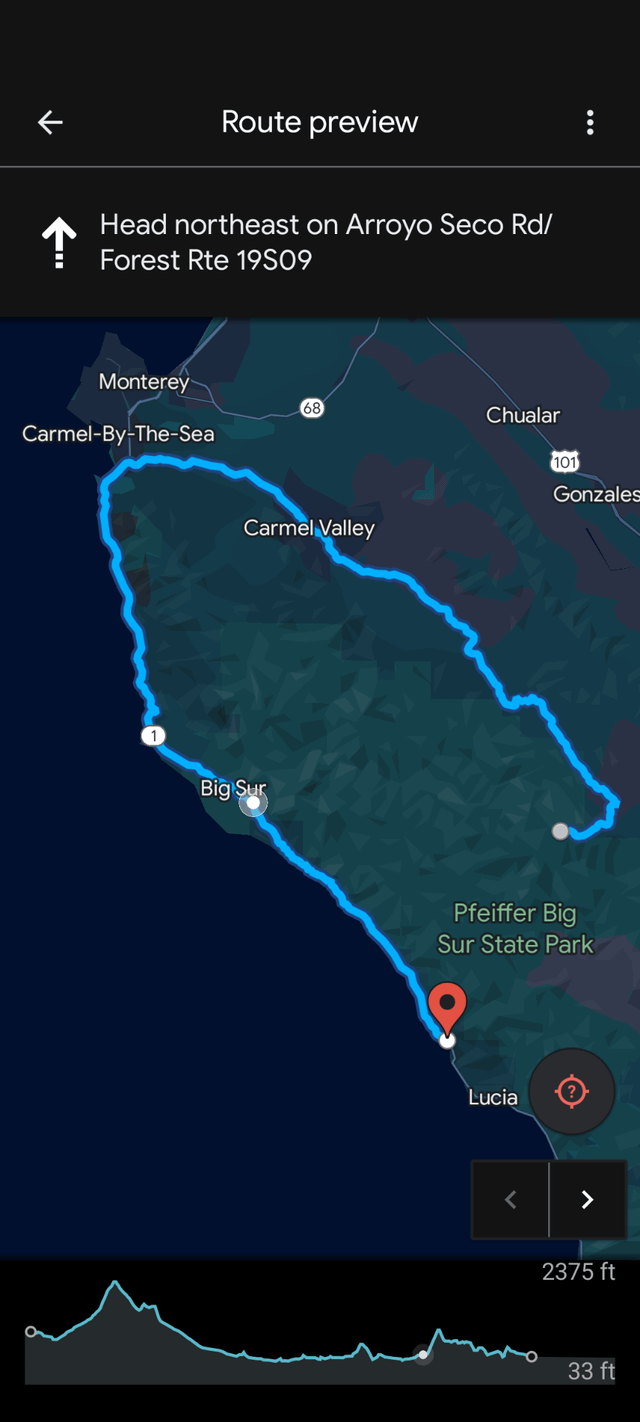
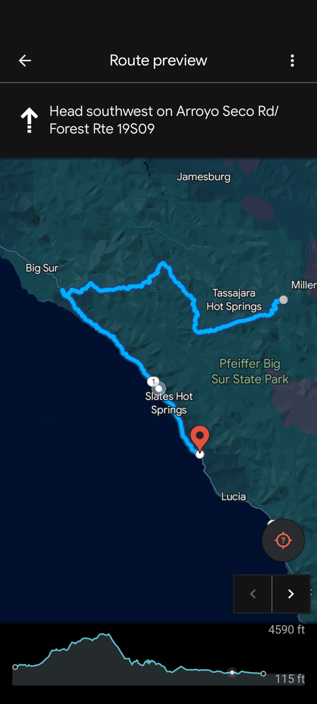
I'm looking for advice on which route to take to get around the closure. My intuition is telling me to double back all the way to the Carmel Valley turn off and take Carmel Valley Road to Arroyo Seco Rd to Nacimiento Ferguson Rd.
However, Google Maps suggested an alternative route that would be about 40 miles shorter but it looks like its on wilderness hiking trails that wouldn't allow bikes? Is this a mistake on Google's part or am I missing something?
The shorter route Google suggests is on Pine Ridge Trail, Black Cone Trail, and Marble Peak Trail. I'm almost certain this would not work with my Surly Disc Trucker and panier set up but I figure it doesnt hurt to double check. Also curious if anyone has a better way around in mind?
Thanks for your help!
by geronimopuku
1 Comment
It will be difficult, but you can take Carmel Valley -> Arroyo Seco -> Indians Road -> Del Venturi -> Nacimiento Ferugusson. Its very mountainous and probably a long way without any resupplying or maybe even water, so I would look to see if anyone has done that route before. The other option is to go out from the Carmel Valley to King City and then to Jolon Road to Nacimiento Fergusson.