
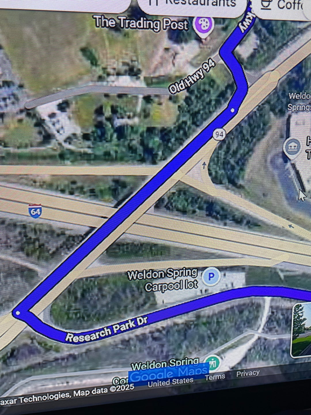
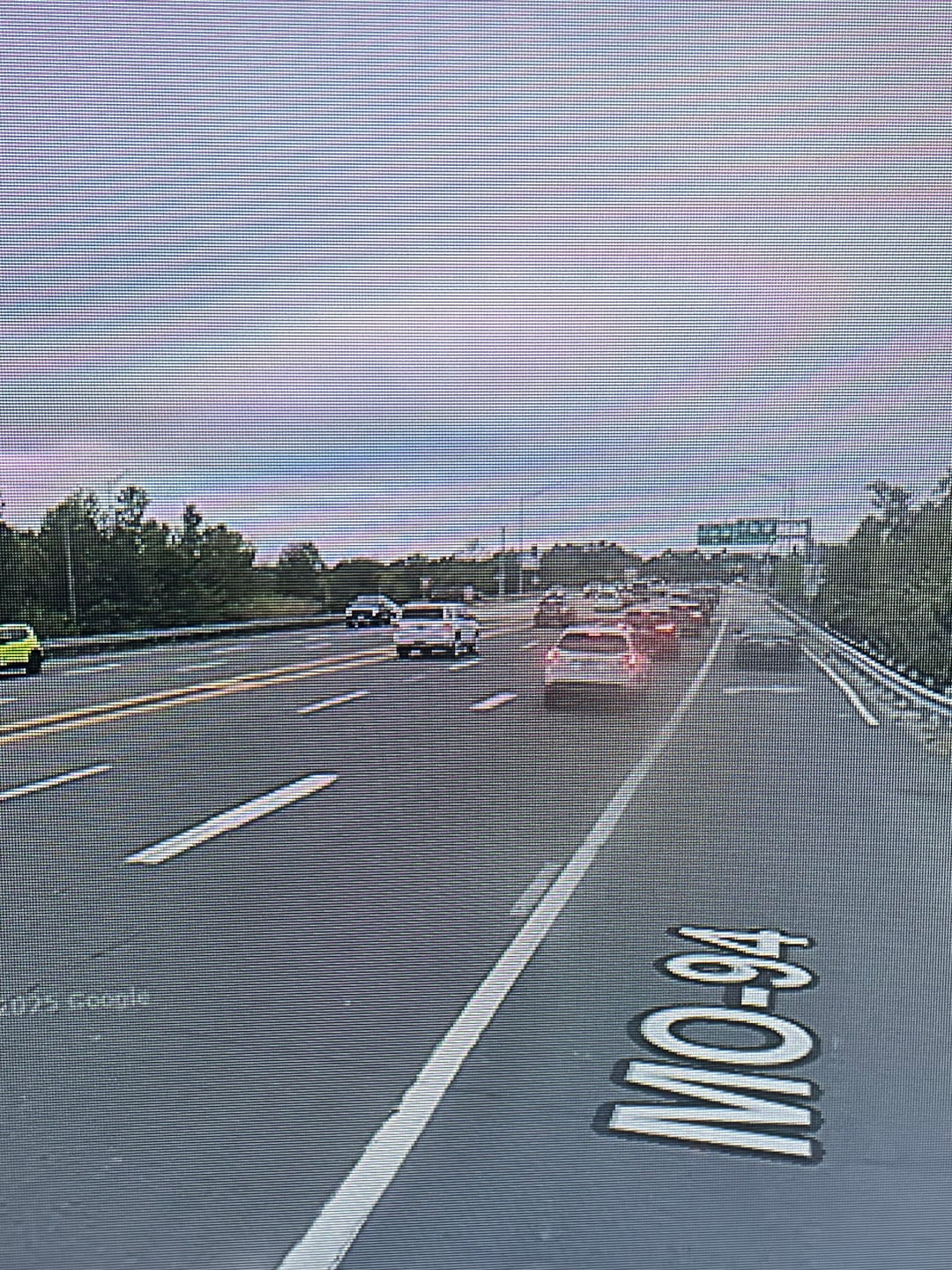
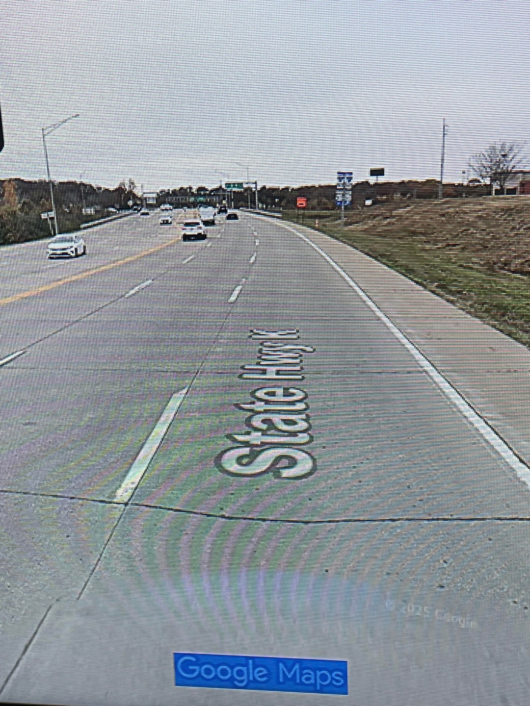
Not sure if this is the place to post or if I should post in the cities thread but I’m moving to St.Louis and I’m trying to plan a route to commute to work by. Most of the route is on a trail but there’s this one trouble spot in the beginning (or end) in which I’m not sure what to do. Google maps says to hop on MO-94 for .2 miles before taking a left turn but it seems like a busy 3 lane with no shoulder for part of it. However if I rerouted my path and went down Highway K it has a nice shoulder the entire way down. Am I over reacting about the route or is the highway better? Any advice or opinions would be appreciated thanks!
by Kilks319
4 Comments
I would take a day to wander the area and see if you can find a desire path. I always find one on the day I get a flat and have to walk a route i normally speed past
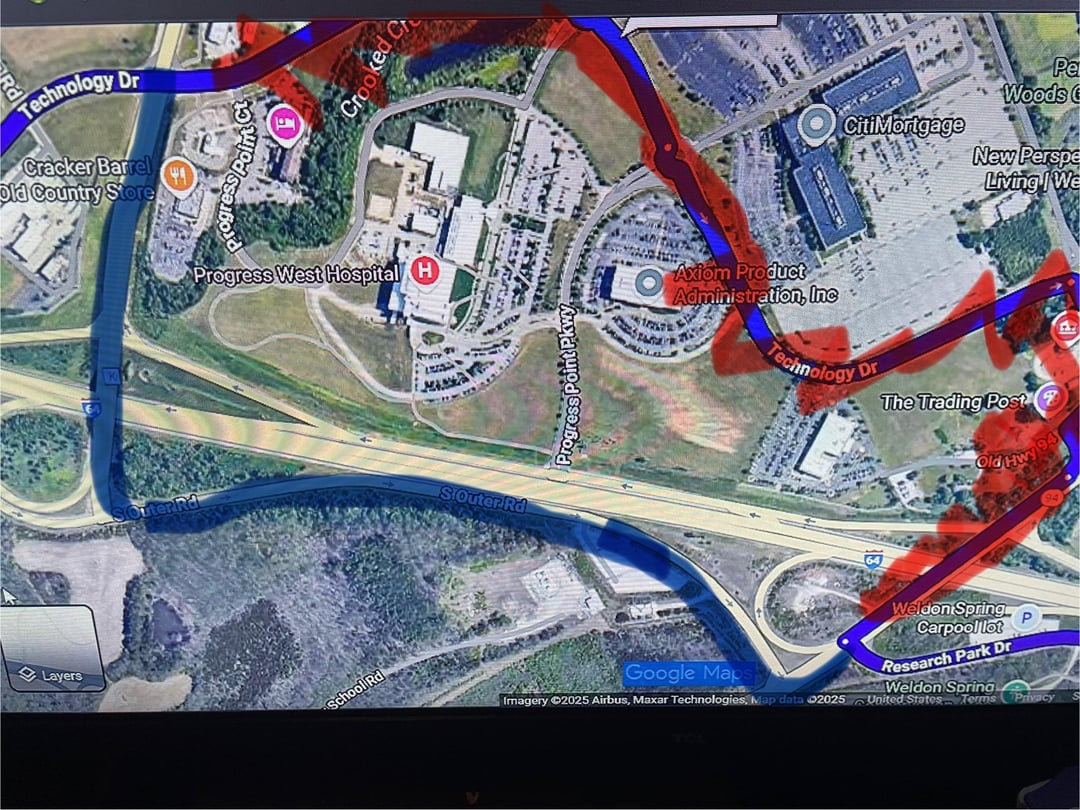
So are you going from the carpool lot area towards the Cracker Barrel area? I assume based on your notes and the red part (blocked out route?). The blue route goes along S Outer Rd which is one way. Is there a way you can cross 64 earlier (or further) in the route so that you go on smaller roads with shoulders?
Any stretch without a protected bike lane on a road with more than 2 lanes would be a hard no for me. But I live in a place with exellent bike infrastructure, so my expectations are high.
Bases solely on Google maps, I would take the 1.5 mile detour to cross I-64 at Research Park Circle and avoid those roads.
https://imgur.com/a/Kn3dJZL
You could also check the Strava heatmap for safer routes or try an app with better bike routing such as Komoot to look for other alternatives.