
Hey fellow tourers,
A while ago I made a custom map of all the trips I did with my girlfriend for her anniversary. I did it in GIMP (like Photoshop) and it was a pain in the ass to do.
So I started building a tool to make it way easier. You can:
- import GPX files
- drop markers on the map to create routes.
- or just type in cities/places and connect them automatically
It also display the name of the cities you put a marker on or type in on the map.
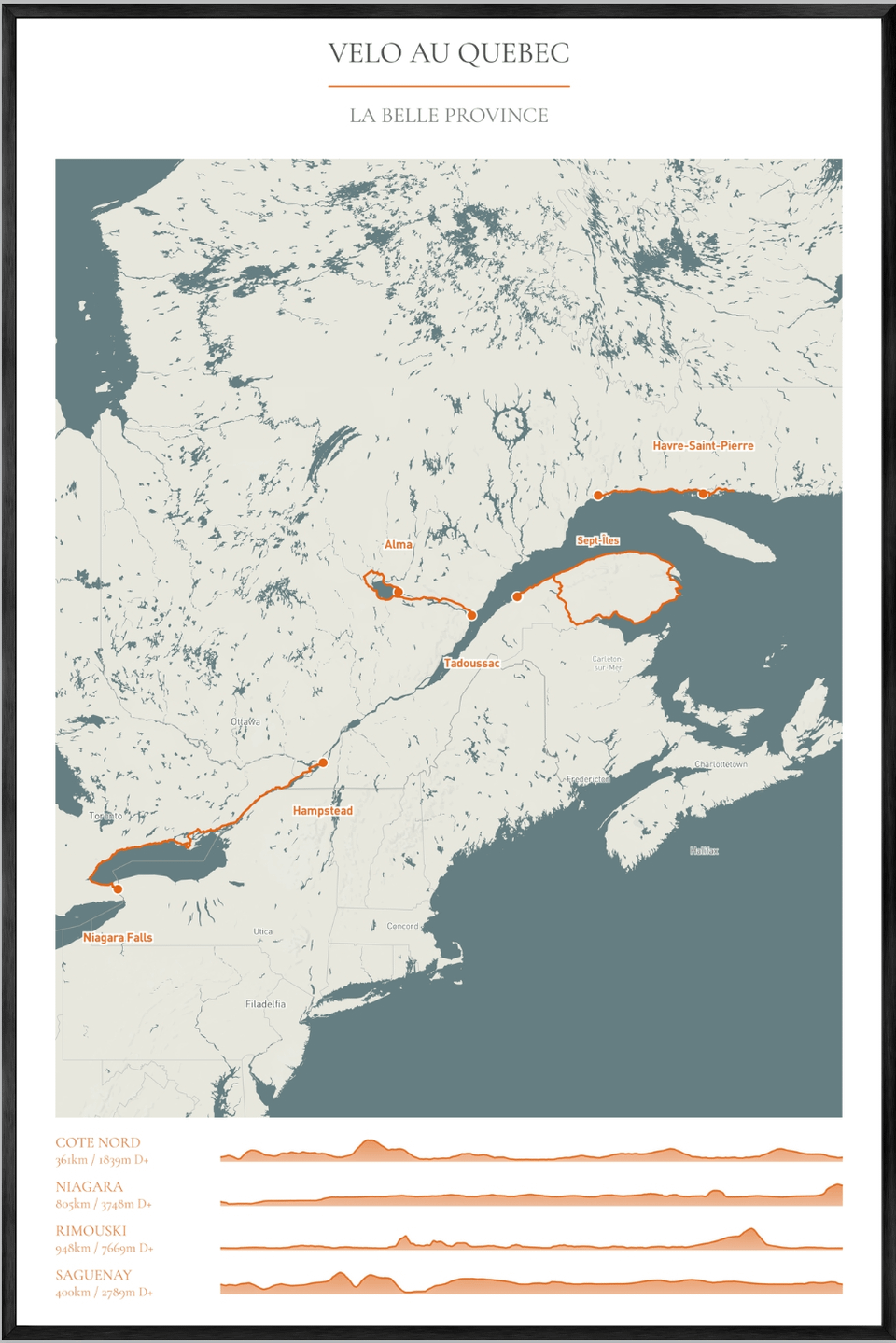
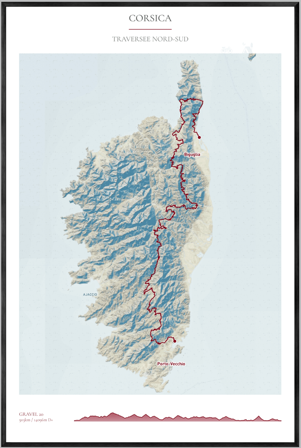
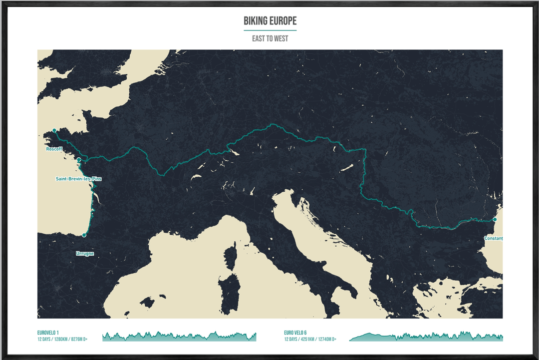
It calculates elevation of those routes, lets you combine up to 4 routes on the map. with relevant stats like total elevation and distance. You can modify the section to add the duration of the trip.
And then the file can be exported in high-res (up to 36×24 at 300 DPI). The idea is that eventually you could order a print-on-demand copy to hang on your wall.
the first 3 images are examples of canvas I create with it.
I’m curious, would this be something you’d use? And if yes, what would you want to see added to the map itself?
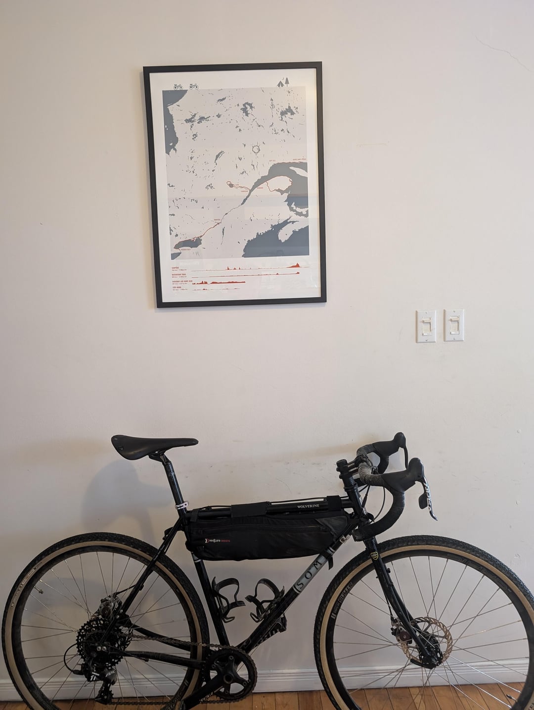
BONUS PIC : the intial gift for my gf I made with photoshop and my touring machine.
by web_pandemonium
4 Comments
Those look really nice and I would be interested however blue should be water.
Totally would use it. It seems similar to minimalmaps.at
These look awesome, I’d definitely be interested.
Personally, I’d prefer topo maps over the minimal aesthetic.
I’d use it and I love the way Pic 2 shows the elevations, does the tool let you choose different styles of map? For example could you choose if you’d want it to look like Pic 2 or Pic 3
I also think eventually adding more than 4 routes would be cool if possible. So someone could have a big map of a continent for example and put all their trips on it.