
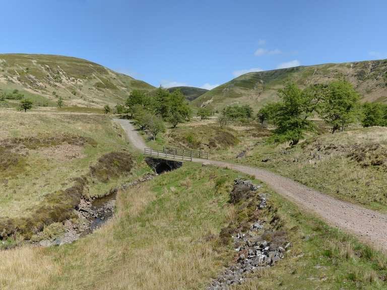
The Welsh section of my trip ended up being tougher than planned, due to following a route that was 100km longer than the one I intended (and definitely rougher), because I downloaded from Strava instead of Komoot… didn't check that the metric and imperial distances were the same. That extra distance was added in painful routes.
Specifically this was Katherine Moore's Sarn Helen route
Komoot: https://www.komoot.com/collection/940661 306km
Strava: https://www.strava.com/routes/29035085?hl=en-GB 398km
Now, my main issue isn't that it's longer, it's that the route on Strava takes some paths that I wouldn't advise anyone to take… e.g. the monk's trod, in Wale's mini Scotland. It was about remote as can be in Wales, and the views and serenity were stunning, but thanks to 4x4s and the like abusing the trail, it's in desperate need of repair and just wasn't ride-able in any sense of the word. Incredibly boggy, marshy and with several possible tracks to take, all of them terrible. After crossing the river, I thought that it'd soon be over before I'd get to the gravel road, only to have to cross a lumpy grassy land slog. I'm not sure I'm glad I did the trail, but I wouldn't return unless I'm simply hiking with a nice meal and dry clothes to enjoy at the end. Don't attempt it with a loaded bike unless it's bone dry.
I can't remember exactly where, but at times I had to deviate from the Strava route due to it wanting to take a path that whilst did technically exist, probably had a gradient over 30% downhill that was overgrown and at points had fully grown trees within it, when there was a nice winding gravel road down. The Komoot route takes that nice gravel road.
As for why I didn't just download from Komoot… I didn't want to pay to export the .gpx. I'll find a workaround or just pay next time, but suffice to say those were avoidable slogs that ended up helping cut my 2 week trip short from Land's End to Bangor short slightly to Harlech and a considerable number of knocks and pains I gained from the monk's trod. Probably should've guessed that a route on Red Bull's profile would include some surprises like that.
P.S. the first leg of my trip, Land's End to Bristol was from https://www.mtbepicsuk.co.uk/gps/#lejogleb, from which I just took the cycle route to Cardiff where a had a rest night (cheaper than Bristol) before joining onto the Sarn Helen route in the Brecon Beacons. Loved the trip, but christ it got tough in Wales, tougher than an already tough route needed to be.
by divbyda0
1 Comment
The Monk’s Trod is specifically why I started an OpenStreetMap discussion on how to map boggy paths. No route planner should be going that way! https://community.openstreetmap.org/t/soft-and-boggy-paths/8429