
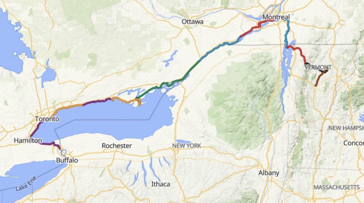
Hey Peeps. Planning this 750 mile tour from Montpelier VT to Montreal, and then down the length of Ontario and finishing in Buffalo.
Would love some feedback from any folks that have done this similar tour. I know most folks usually reverse course and that we’ll face headwinds.
Mid July is our start date and we’ll average 50-60 miles a day.
Anything to know about? Worry about? Bugs? exciting things to see?
Thanks for any help.
by flannel_lorde
3 Comments
The waterfront trail in Niagara is a service road along the QEW, usually has shoulders, sometimes gravel, sometimes meanders through small housing developments, often just the shoulder, a fence and then the QEW, sometimes a noise wall. It’s hot, no shade, and the taste of exhaust. The speed limit is 80, most go 100. When the QEW gets backed up, it’s packed with cars all desperate to get one more meter as quickly as possible.
A lot of cyclists ride it, but if you have the time, going up on the escarpment and riding through the heart of Niagara would be much more peaceful and safe. If you’re not too heavily loaded you could go up the Red Hill Trail, it’s mostly pavement but some dirt and has some short steep sections that you’d probably push your bike up (balance the load on the bikes or the tail will slide away from you when you push uphill if it’s too heavy). Route 20 or Centennial would be an alternative but no bike lanes, there are other quiet roads up the escarpment but they’re very steep, the trade-off may be worth it. You could make your way to the Dofasco 2000 trail and then along the roads that extend east from it. Niagara is farming country so pretty unshaded and dusty if it’s been dry, but when you get past Beamsville it turns into wooded landscape. You can cross the border at Fort Erie or Niagara Falls. Fort Erie doesn’t have a staffed desk for pedestrians/cyclists, so you have to ring a bell and wait. Niagara Falls does have a staffed desk, and you ride across the bridge with the cars which is kind of fun. The Niagara Parkway is pretty around Niagara Falls but after that is just sidewalk along the parkway, with houses on one side and some brush and the river on the other side, i.e., not very scenic.
Anyway, I know that’s a small part of your ride, but I think the main point probably applies through most of the Toronto area: the waterfront trail will often be pretty gruesome. It would be worth it to dig in deeper and see what the trail looks like and try to find some alternatives. Baking in the hot sun with asphalt radiating heat while inhaling car exhaust day after day will not be enjoyable.
I did this route 4 ish years ago, but going east. We cut over at Ticonderoga and really enjoyed the ride along Lake Champlain (lots of “old” history French and Indian war/revolutionary/war of 1812). Some really unique old forts. And of course we enjoyed all the ferries across the lake.
I enjoyed the ride west of Niagara. Lots of farming and farmer stands for fresh veggies. But as someone else said. It can be exposed and hot.
We found camping along the way booked solid. But that was right after Covid. So maybe things have slowed down a bit.
I live in Hamilton and do a bunch of rides to Niagara Falls. Here is a route from Burlington to the falls that is my favorite route. Niagara on the Lake is a nice little town along the way not to miss.
[Burlington to Niagara Falls](https://www.komoot.com/tour/3021545818?share_token=ad97Rrpk2oC8jKDRyDzSOWooZyEie4uiQbfrhtSxC2kxL5kWsn&ref=wtd&t_s=referral&t_cid=route_share&t_ref_username=522323654571)