
I found this website, which reads FIT files from your cycle computer (I have a Bryton): https://www.fitfileviewer.com/
Although you may get errors, it is due to fields not supported. It works fine for me. Once uploaded, you can get a chart and a map. The map view also has a link to download a converted GPX file that can be used elsewhere. Try this site. You'll love it. https://mapdirector.com/
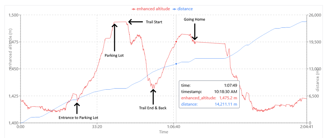
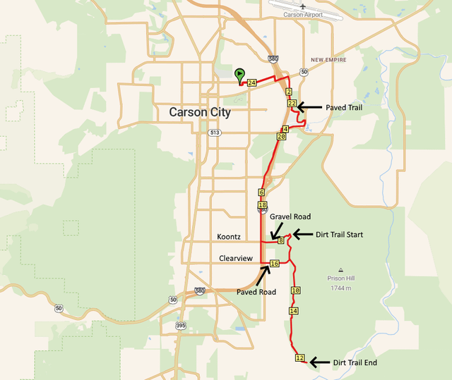
Here are a chart and map from today's ride on the new Prison Hill West Trail that I posted about earlier. I added the arrows and text.
You can see on the chart that the gravel road entrance to the parking lot at the trailhead is quite long and steep, as is part of the trail. If I hadn't lowered the gearing on my G Line with a 47T chainring, I don't think I could have managed.
On the map, I marked the paved trail and the dirt trail. The rest is road. This is from home and back.
by mojoehand